

Gimme a ___ !
Saturday, September 17, 2011
GCCS had their 1st Pep Rally of the year and of course I had to get some pictures of my "Cheerleader" to show you all...


Our Anniversary HIKE!
Wednesday, September 14, 2011
Mark has been planning a hike for our anniversary for months now and since he had already done this particular hike twice, I totally took his word for EVERYTHING! Well, NEVER AGAIN, I should know better (bang your head against the wall moment)... I have believed for months now that this hike would take us about 2 hours - 1 hour up and then another hour back down - WHY, you ask? because that's what Mark told me! BUT that's not how the story goes...
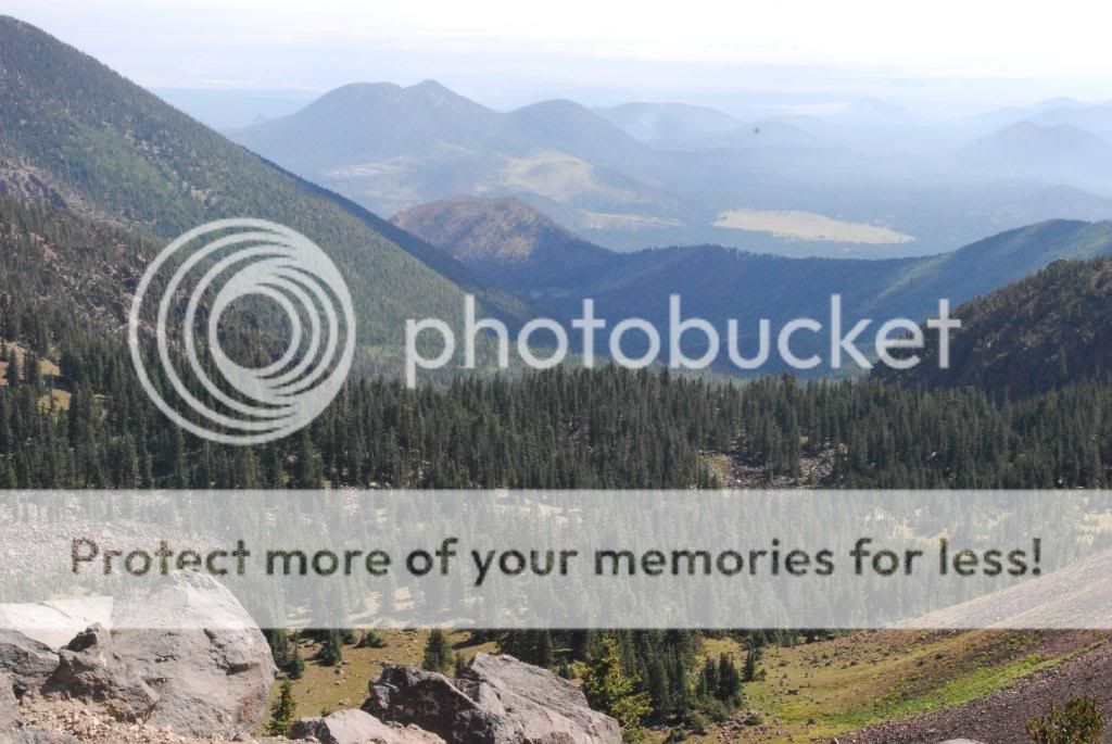
The highest point you can see in this picture below is where we are headed, Mt. Humphrey's, the highest peak in Arizona.

Here we are at the beginning of the trail head - it's 8:00AM - 57 degrees COLD - elevation 9,100 feet.


There's the peak, can you see it?

Empty chair lifts, just waiting for the snowy weather... and the opening of AZ Snowbowl Ski Resort.

Ahead is the forest that we will be hiking through and above the forest / tree line is the peak - OUR DESTINATION!

Here we go, entering the forest.


At this point we are about 1 hour into the hike and I'm thinking we should be at the top by now... but OH NO!

This was a landmark of a natural rock slide, it was a pretty awesome sight to see. As far up as the eye could see, a path of nothing but rocks, which I am assuming at one time took out a line of trees.

I had warmed up a bit by now, my jacket had been off for at least a half hour. After this little picture break, I even slipped out of my warm up pants. I had shorts underneath - remember I was all prepared for our 2 hour hike. So at this point already having been climbling for an hour, I started asking a few questions which I finally summed up to Mark having a really bad memory or he just lied to get me up here.

When we took off from this spot, a few groups of people had caught up to us on the trail. There was probably about 25+ random strangers climbling with us and you know Mark, he was steady making new friends. Me, I was thinking I am ready to get to the top, so I started climbing really hard NOT KNOWING that I should have been saving my energy because I still had 5 more hours to go before I would get back to the car...

so I climb, and climb, and climb passing everybody I came upon until I was TOTALLY worn out. Finally, I could see people above me, I had made it to the top just a few more steps and I'd be there and so I PUSHed a little bit more.
I MADE IT! See the next picture below this is the view from the TOP or what I thought was the top. I had heard a few people along the path refer to this as the "saddle." There were lots of people up here, sitting around, resting, EATING! Mark & I brought with us water and 1 orange each, because thinking that we would be completely done in 2 hours, we didn't need more than that. YEAH RIGHT! So, I found a rock to sit on and wait for Mark to reach the top, I had left him back a ways with all his new friends. The elevation at this point is about 11,400.
It felt so good to sit down and rest, so I sat and watched and listened to the other hikers around me. I kept hearing others talk about having to still climb another hour before they would reach the top. After hearing this from several others, and seeing everybody but me (Mark hadn't caught up yet.) enjoying full course meals, watching others pack up and continue further up the mountain - the puzzle pieces began to fall into place. THIS WASN'T THE TOP! What do you mean, this wasn't the top, just wait until Mark caught up...

See the sign below, I found this while waiting on Mark. It reads: Humphreys Trail Humphreys Peak > that arrow is not pointing back toward my car, it is pointing to somewhere FURTHER UP THE MOUNTAIN. At this point, I am TIRED & hungry and my 2 hour limit is UP! But I ask a few questions of some of my fellow hikers and found out that THE TOP is at least another hours hike up the mountain. So while I continue to wait for Mark, I am thinking when he reaches me, we are done and we are going to turn around and head back down because if it took us 2 hours to get to this point then we have a 2 hour hike back down. I just knew that I was completely DONE, there was nothing left in me, I just wanted to go home...

So Mark reaches me, and I explain to him all that I found out while waiting on him. But did we rest and then start heading back down, NO! Although I had warmed up hiking up to the saddle, while sitting and waiting for Mark, the sun went away and I started to get cold so I slipped back into my sweatsuit. I knew, I knew, I knew that we should not have went any further, but that little stubborn side of me that doesn't like quitting at anything convinced me that I couldn't come this far and not finish, sooooooooo
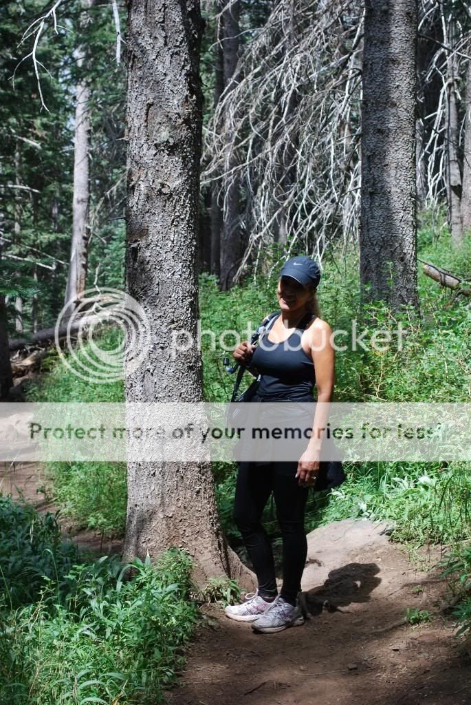
here I am all bundled up again and ready to continue. At this point, I could care less about taking pictures, I just wanted to finish and go home. In the picture below, I was frowning because it was getting really cold again - HINT the 1st sign that should have told me to QUIT! I had also at this point mentally shut down, I wanted to go home and home is where I should have headed...


My car is somewhere down there, 2 whole hours in the opposite direction. We started to climb, still hadn't eaten those oranges yet, no breakfast, very little water, tired, no energy, and COLD! A few minutes into the climb and the sun was completely gone, the wind starts blowing and I'm thinking we are not prepared for this kind of weather we need to turn back.


A few minutes later, it starts to RAIN and I am struggling with myself not to turn around. We keep going and it starts to HAIL and the temperature keeps dropping, my hands are freezing but we keep going. Hikers all around us now have on their raincoats and other gear, but not us WE WERE NOT PREPARED for this hike. FINALLY, I climbed over one more rock and I can see the top, hikers are up there sitting around and I'm thinking I am almost there, it's within my reach AND THEN it starts to SNOW and that was it, I said to H--- with this I AM DONE! I turned around and started back down and all I could think about was we have at least 3 hours to get back to the car...

Mark, really wanted to take pictures...

and all I wanted was to FINISH!

There were points where I could have literally sat down in the middle of the forest trail and cried like a baby. I wanted out of that forest so bad they could have sent a rescue team after me. 6 HOURS, SIX! How does somebody do the same hike twice in their life and not remember that it takes way more than 2 hours to complete this hike?


Look at all the cars in this parking lot, there where hundreds of people on this trail. THEY ARE ALL CRAZY!

At that moment, there was nothing more BEAUTIFUL than the sight of my car... if I could have ran to it, I would have.

There's the "PEAK" again behind me, NEVER DO I WANT TO SEE IT AGAIN! Mark says I'll change my mind, hmmm he still doesn't know me very well.

Here are the TRUE facts about Mt. Humphreys: Humphreys Trail which I should have look up for myself BEFORE the hike... LESSON LEARN the HARD Way!
| Highlights: | Strenuous hike to the highest point in Arizona, spectacular 360 degree views | |
| Near: | Flagstaff, AZ | |
| Scenery: | ||
| Distance: | 8.25 miles round trip | |
| Elevation Gain: | 3272 ft | |
| Hike Time: | 5 hours | |
| Difficulty: | Strenuous | |
| Trail Condition: | OK, but a few difficult spots | |
| HikeType: | Out and Back | |
Summary: Humphreys trail takes you to the summit of Mount Humphreys, the highest point in Arizona, at 12,633 feet.The trail starts out in a nice flat meadow, but quickly gains elevation as it ascends in a series of long switchbacks. After about 3 miles, the trail reaches a saddle at 11,800 feet. This saddle connects Humphreys Peak with Agassiz Peak to the south. From the saddle, the Humphreys Trail continues north for another mile as it passes several false summits. The trail follows the rocky treeless ridge to the main summit. The final mile to the to the summit should not be attempted if thunderstorms threaten. Mount Humphreys is the highest point for hundreds of miles around and a large portion of Arizona is visible from the summit. As you stand on the summit you will gain a real sense of standing on top of the world.

My anniversary flowers!

Subscribe to:
Posts (Atom)